The Belgian Ardennes, located in the southeast of Belgium, is a region full of charm, history, and adventure. This hilly to mountainous landscape, with dense forests, idyllic river valleys, and picturesque towns, attracts nature lovers, history enthusiasts, and adventurers alike.
Interesting Places
Here is a selection of the most beautiful places that should not be missed on any trip:
Namur, the capital of Wallonia, lies picturesquely at the confluence of the Meuse and Sambre rivers. The Citadel of Namur, one of the largest fortresses in…
read more 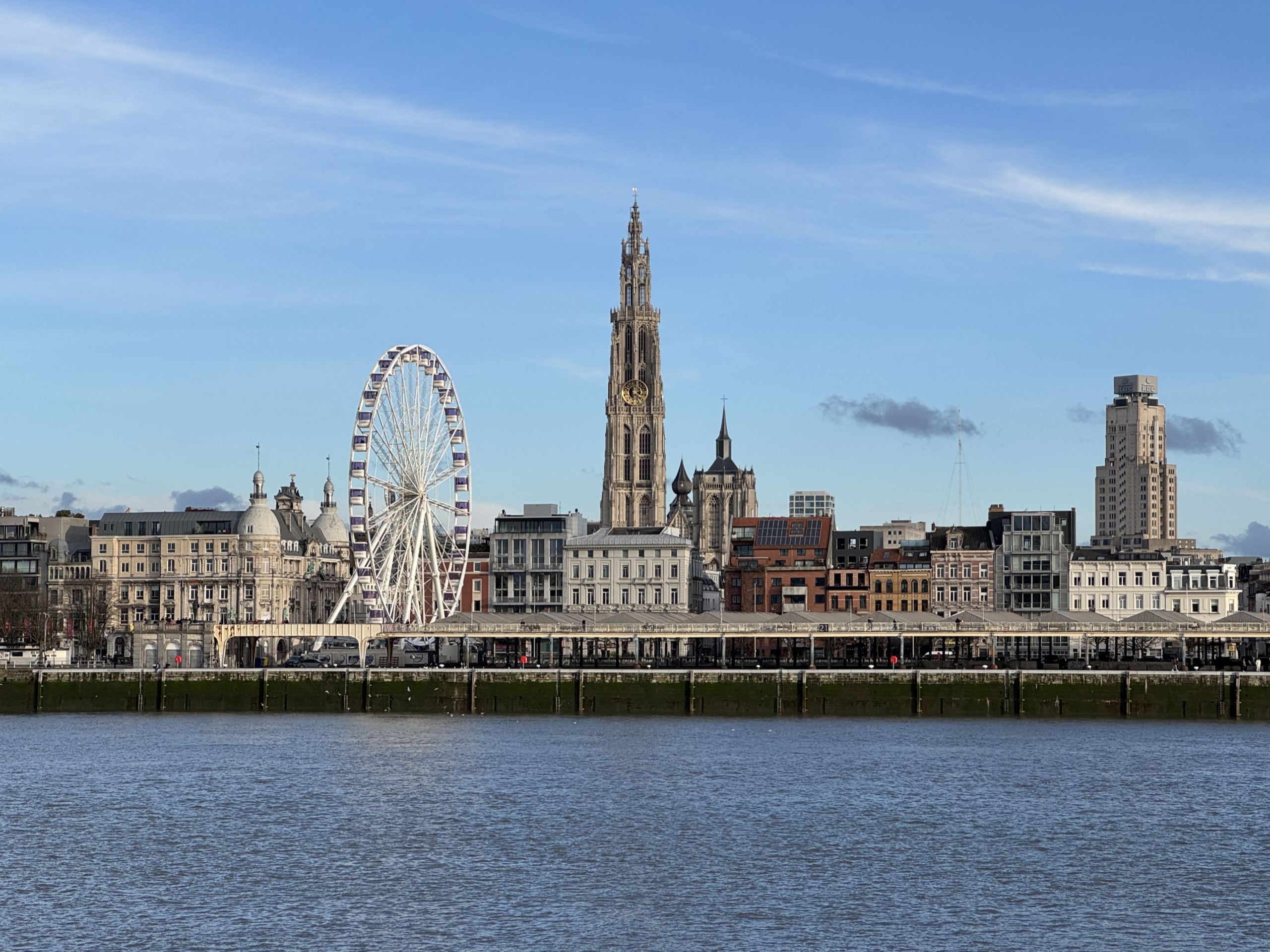 Belgium has one of the densest inland waterway networks in the world. The main routes can be broadly divided into three categories: the “major arteries”, connecting canals, and scenic waterways used primarily for tourism.
the major Arteries
Scheldt
The Scheldt rises in Gouy in northern France and flows into the North Sea near Vlissingen in the Netherlands, after about 350 kilometers. In Belgium it is the most important waterway, the port of Antwerp is the second largest in Europe. The river also flows through Ghent… read more
Belgium has one of the densest inland waterway networks in the world. The main routes can be broadly divided into three categories: the “major arteries”, connecting canals, and scenic waterways used primarily for tourism.
the major Arteries
Scheldt
The Scheldt rises in Gouy in northern France and flows into the North Sea near Vlissingen in the Netherlands, after about 350 kilometers. In Belgium it is the most important waterway, the port of Antwerp is the second largest in Europe. The river also flows through Ghent… read more 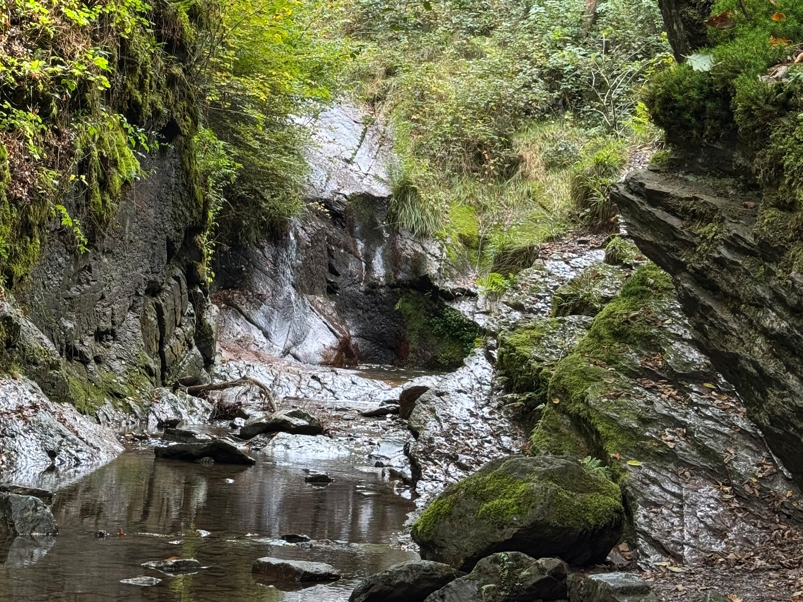 Between the hills of the Ardennes, south of Liège, the Ninglinspo stream winds its way through a narrow valley that is considered one of Belgium’s most attractive hiking areas. This small tributary of the Amblève flows through a landscape that feels both wild and almost fairy-tale like. Hikers here encounter a nature that changes in short intervals: narrow gorges, rocky paths, small waterfalls, and pools where clear water shimmers.
The stream flows between Vert-Buisson (Theux) and Sedoz-Nonceveux (Aywaille). Over a length of 3 kilometres, the…
Between the hills of the Ardennes, south of Liège, the Ninglinspo stream winds its way through a narrow valley that is considered one of Belgium’s most attractive hiking areas. This small tributary of the Amblève flows through a landscape that feels both wild and almost fairy-tale like. Hikers here encounter a nature that changes in short intervals: narrow gorges, rocky paths, small waterfalls, and pools where clear water shimmers.
The stream flows between Vert-Buisson (Theux) and Sedoz-Nonceveux (Aywaille). Over a length of 3 kilometres, the… 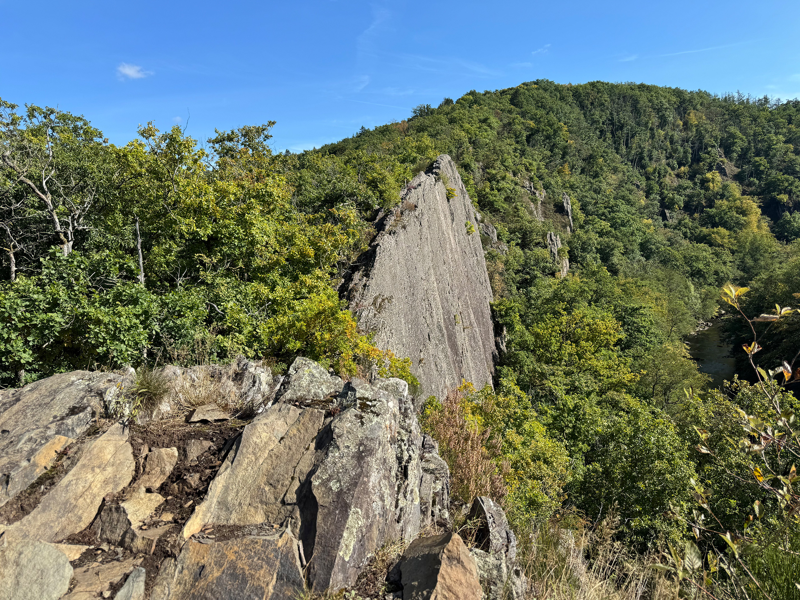 Le Hérou is one of the most striking landscapes in the Belgian Ardennes. It is a long ridge of slate, stretching for 1.5 kilometers along a tight meander of the Ourthe River, rising to a height of 80 meters. The rock emerges here in sharp edges and steps, forming a crest that is at times so narrow that the slopes drop almost vertically down to the river bend on either side. For hikers, this creates a path that resembles a natural footbridge: rugged, uneven, yet…
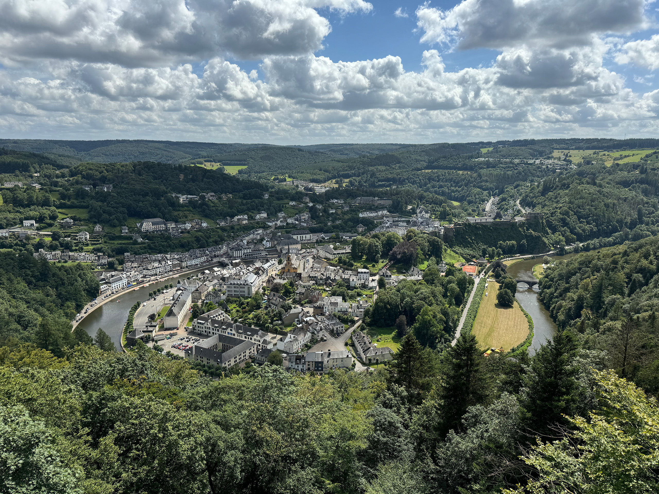
 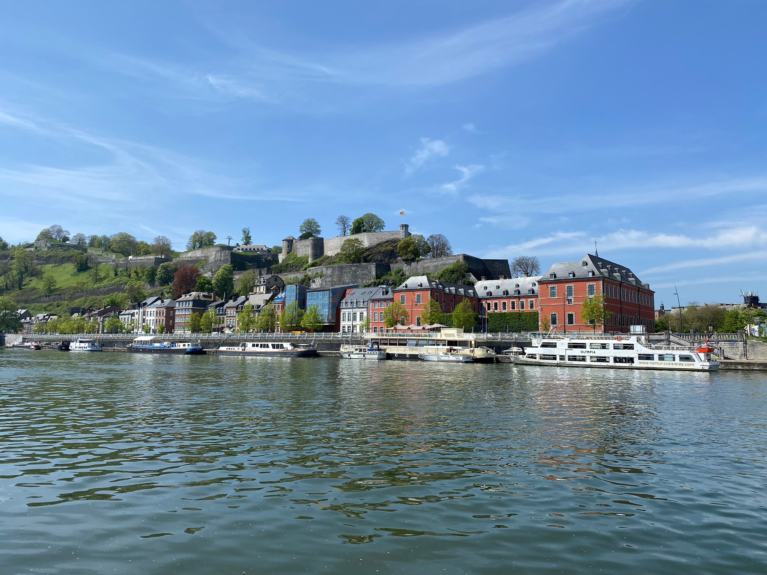 The Meuse is one of Western Europe’s great rivers. It rises in France near the village of Pouilly-en-Bassigny and winds its way for more than 900 kilometers through France, Belgium, and the Netherlands before flowing into the sea at Rotterdam. In Belgium, the river cuts through the heart of Wallonia, shaping the landscape, the cities, and the history of the region. Its character is remarkably diverse.
North Meuse
A striking feature is the contrast between the two main Belgian sections of the river, north and…
The Meuse is one of Western Europe’s great rivers. It rises in France near the village of Pouilly-en-Bassigny and winds its way for more than 900 kilometers through France, Belgium, and the Netherlands before flowing into the sea at Rotterdam. In Belgium, the river cuts through the heart of Wallonia, shaping the landscape, the cities, and the history of the region. Its character is remarkably diverse.
North Meuse
A striking feature is the contrast between the two main Belgian sections of the river, north and… 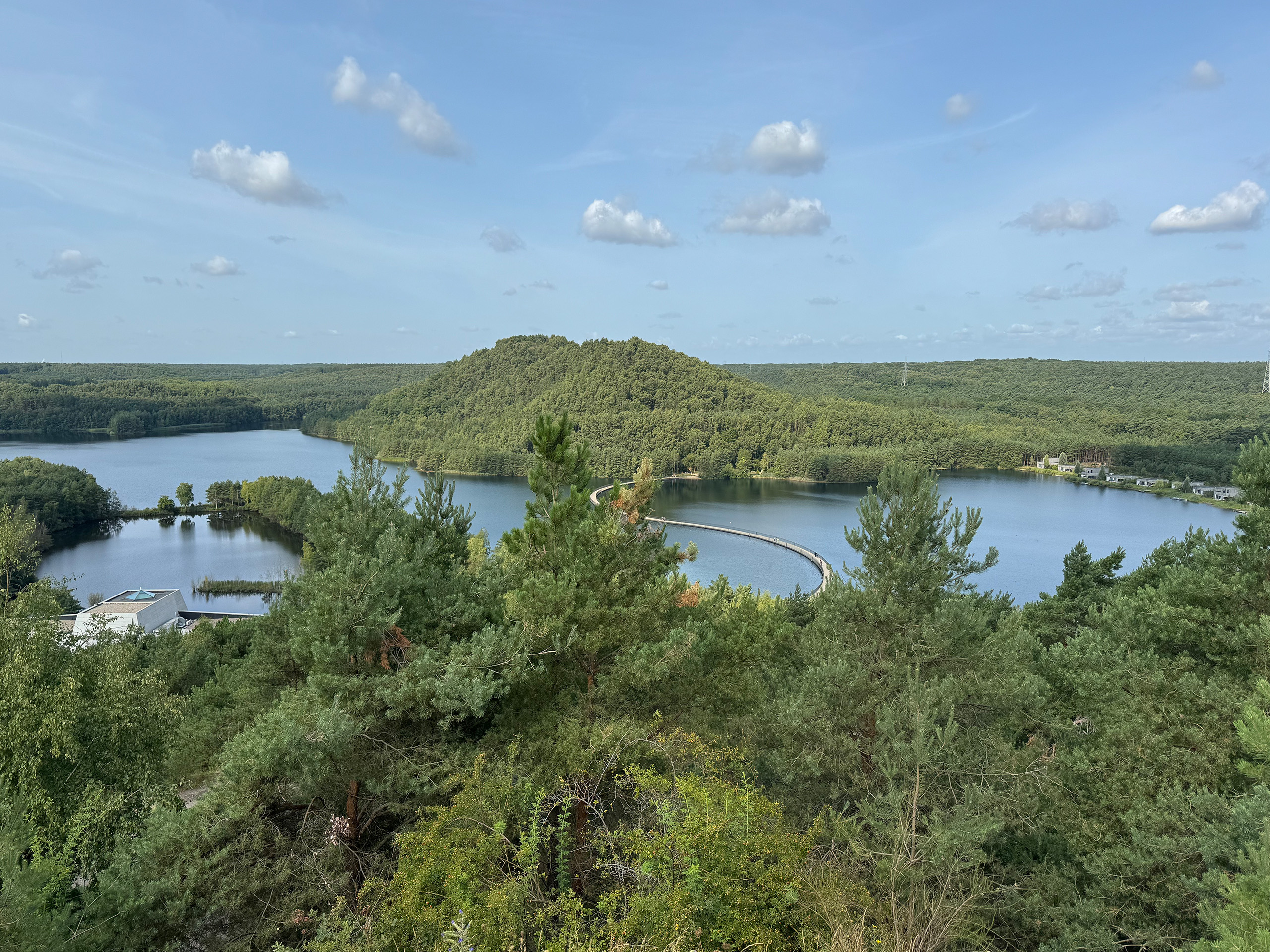 The Hoge Kempen National Park is located in the province of Limburg, in eastern Belgium, and covers an area of around 12,000 hectares. It is the country’s first officially recognised national park and encompasses a mosaic of heathland, pine forests, dunes, lakes, and gently rolling hills. The area is part of the Flemish Kempen, a region with sandy soils that, for centuries, was rather barren and difficult to farm. Today, it is considered a valuable natural landscape, home to numerous rare plant and animal species.…
 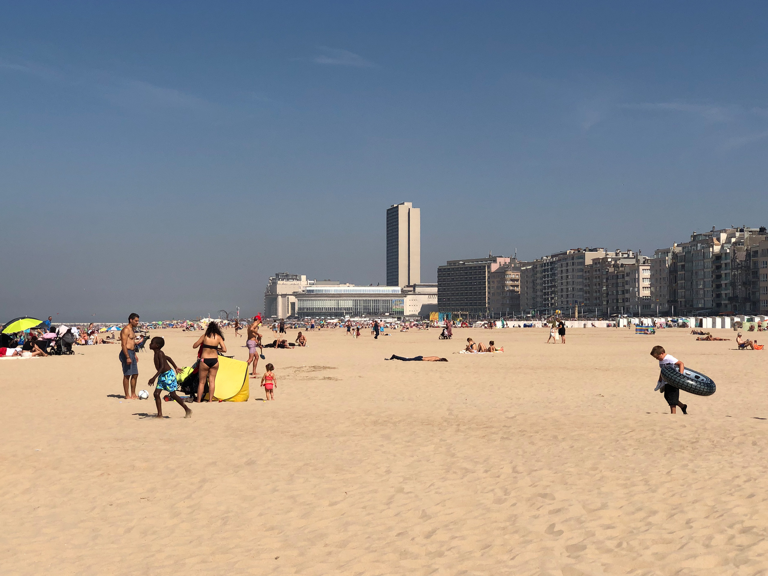 The Belgian coast stretches for 65 kilometers along the North Sea, forming the country’s westernmost coastal area. It runs from Knokke-Heist near the Dutch border to De Panne close to France. Despite its relatively short length, the coastline is densely built-up and heavily geared toward tourism. Thirteen seaside resorts make up the “Kust”, as it is called in Dutch. The entire region lies within the province of West Flanders.
One distinctive feature is the Kusttram, a coastal tram line that spans over 67 kilometers and…
The Belgian coast stretches for 65 kilometers along the North Sea, forming the country’s westernmost coastal area. It runs from Knokke-Heist near the Dutch border to De Panne close to France. Despite its relatively short length, the coastline is densely built-up and heavily geared toward tourism. Thirteen seaside resorts make up the “Kust”, as it is called in Dutch. The entire region lies within the province of West Flanders.
One distinctive feature is the Kusttram, a coastal tram line that spans over 67 kilometers and… 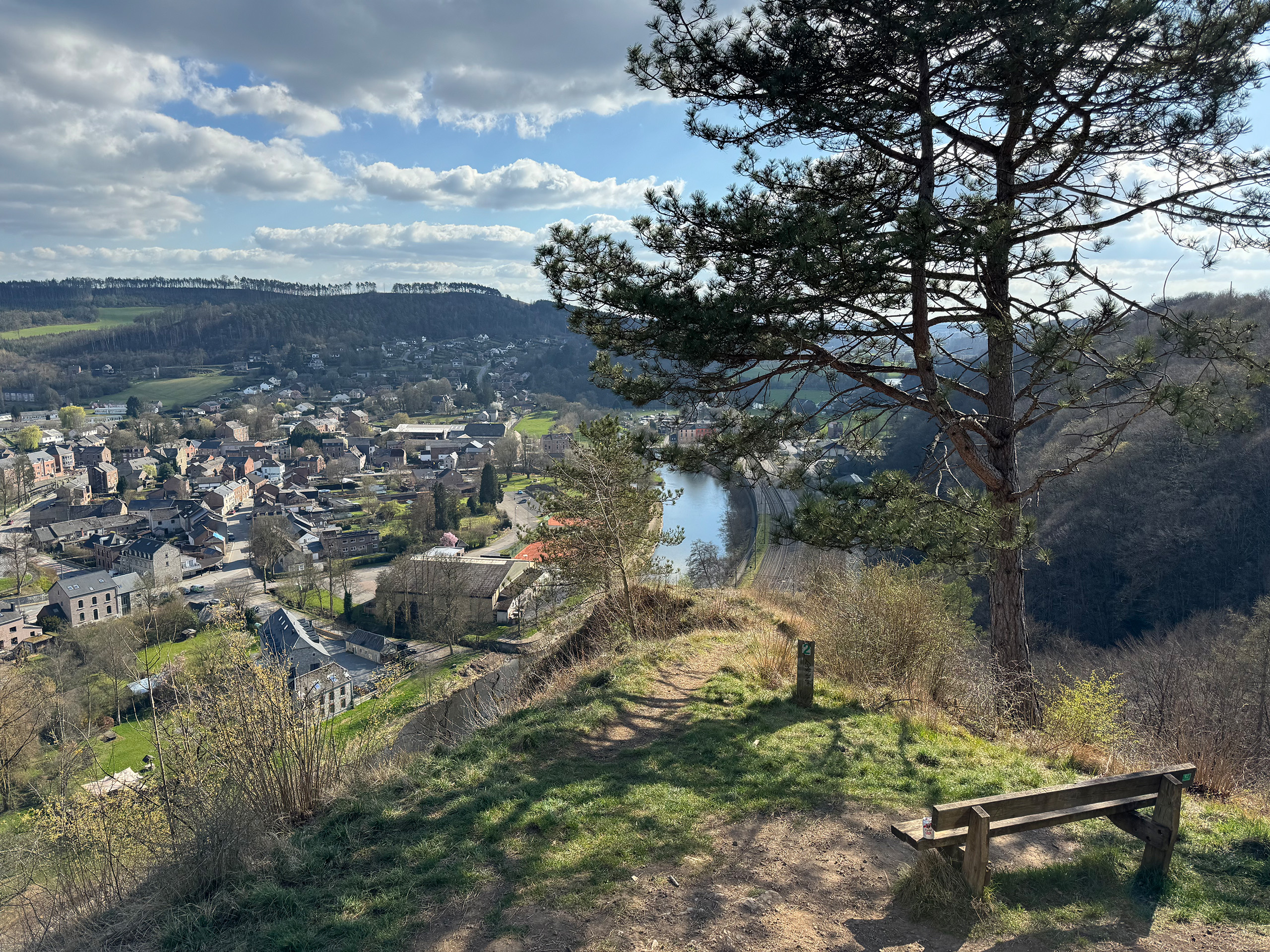 The south of Belgium is known for its low mountain ranges and river valleys, lined with sometimes adventurous rock formations as well as castles and palaces. The most famous is the Meuse Valley between Namur and the French border.
Of course, there are other scenic river valleys. One that I particularly like is the Ourthe Valley, which, apart from a few places, still seems to be a special hidden gem, even though it begins just south of Liège.
The Ourthe is a right-bank tributary of…
The south of Belgium is known for its low mountain ranges and river valleys, lined with sometimes adventurous rock formations as well as castles and palaces. The most famous is the Meuse Valley between Namur and the French border.
Of course, there are other scenic river valleys. One that I particularly like is the Ourthe Valley, which, apart from a few places, still seems to be a special hidden gem, even though it begins just south of Liège.
The Ourthe is a right-bank tributary of… 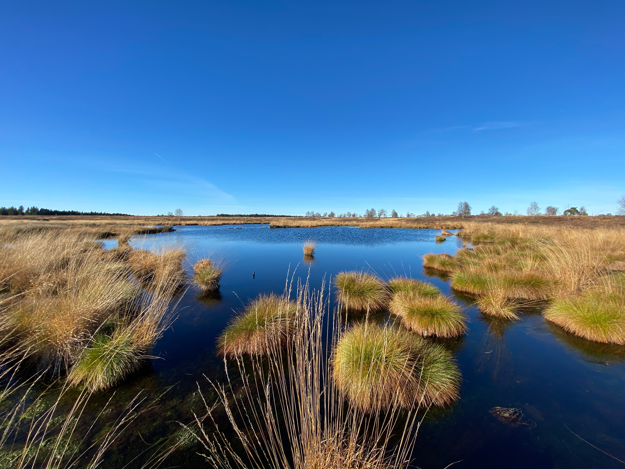 The High Fens (Hautes Fagnes) in eastern Belgium offer nature lovers and adventurers impressive landscapes. Part of the High Fens-Eifel Nature Park, this region stretches from the picturesque Belgian towns of Eupen, Spa, and Malmedy in the province of Liège to beyond the German border.
Large areas of the region are raised bogs, which is where its name originates. At 694 meters above sea level, Botrange is both the highest point in the High Fens and the highest mountain in Belgium.
With its vast moorlands,…
The High Fens (Hautes Fagnes) in eastern Belgium offer nature lovers and adventurers impressive landscapes. Part of the High Fens-Eifel Nature Park, this region stretches from the picturesque Belgian towns of Eupen, Spa, and Malmedy in the province of Liège to beyond the German border.
Large areas of the region are raised bogs, which is where its name originates. At 694 meters above sea level, Botrange is both the highest point in the High Fens and the highest mountain in Belgium.
With its vast moorlands,…