Belgium, the flat Country?
 © VisitBelgium.net
Is Belgium really the “flat land” sung about in Jacques Brel’s famous chanson, the image that many people conjure up when they think of the small state in Western Europe?
The answer is – like so often – a clear “yes and no”.
In his song, Brel mainly evokes West Flanders, with its wide plains along the coast and inland, where fields, canals, and ruler-straight roads dominate the landscape. There, the image of flat expanses is indeed accurate. But for the whole country, the description does not hold.
Much also depends on perspective: for a Swiss person, accustomed to alpine peaks, Belgium appears quite flat. A Dutch person, however, whose homeland lies largely at or even below sea level, perceives Belgium as quite mountainous.
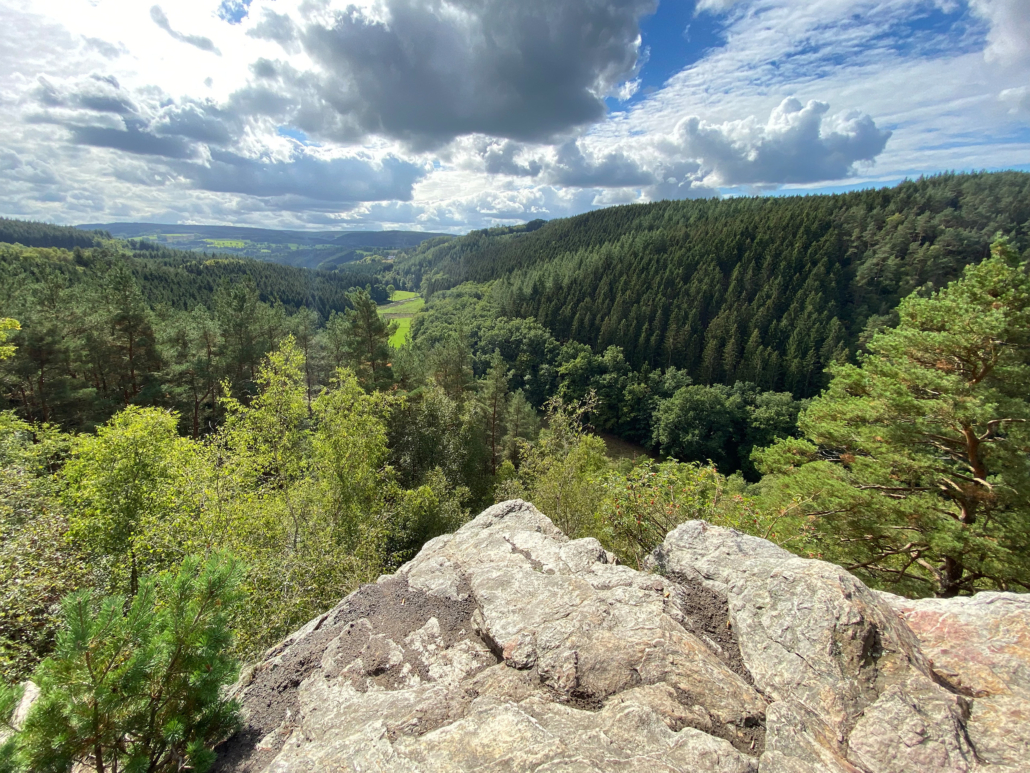
Flanders
Northern Belgium, Flanders, is indeed largely flat. The region owes its topography mainly to the sea and the great rivers. For thousands of years, this was a coastal swamp and floodplain, only made usable through diking and drainage. The coastal polders, today fertile farmland, are still protected by a network of canals, sluices, and dikes. Only a few elevations, such as the Kemmelberg in West Flanders at around 150 meters, rise above the otherwise gentle relief. The constant sea wind and wide horizons shape the landscape and the region’s way of life.
Wallonia
The south of the country, Wallonia, looks very different. It largely rests on the geologically ancient bedrock of the Ardennes, formed more than 300 million years ago. The Ardennes are a low mountain range with a varied landscape: deep, often rocky gorges carved by rivers such as the Meuse, Ourthe, Lesse, or Semois; densely forested ridges, and open plateaus. Here lies the high plateau of the High Fens, with the Botrange as the highest point in Belgium and the Benelux countries (just under 700 meters), where the climate is harsh, with snow often covering the ground for several months. There are also numerous ski slopes, with Baraque de Fraiture, Mont des Brumes and Ovifat being particularly noteworthy.
Transitions
Between the extremes of Flanders and Wallonia lies a transitional zone of gentle hills, such as in Hesbaye or Brabant, and broad river valleys along the Meuse, Sambre, and Scheldt.
Conclusion
About one third of Belgium consists of upland terrain, the rest being mostly flat to gently rolling. The image of the “flat land” therefore applies only in part – while the rest offers a diversity of landscapes, ranging from maritime plains to rocky river valleys to rugged high moors. Belgium thus bridges not only Germanic and Romance Europe, but also sea and mountains – though, across the border in northern France, the land soon becomes flat again.
 © VisitBelgium.net
 © VisitBelgium.net
Leave a Reply
Want to join the discussion?Feel free to contribute!