
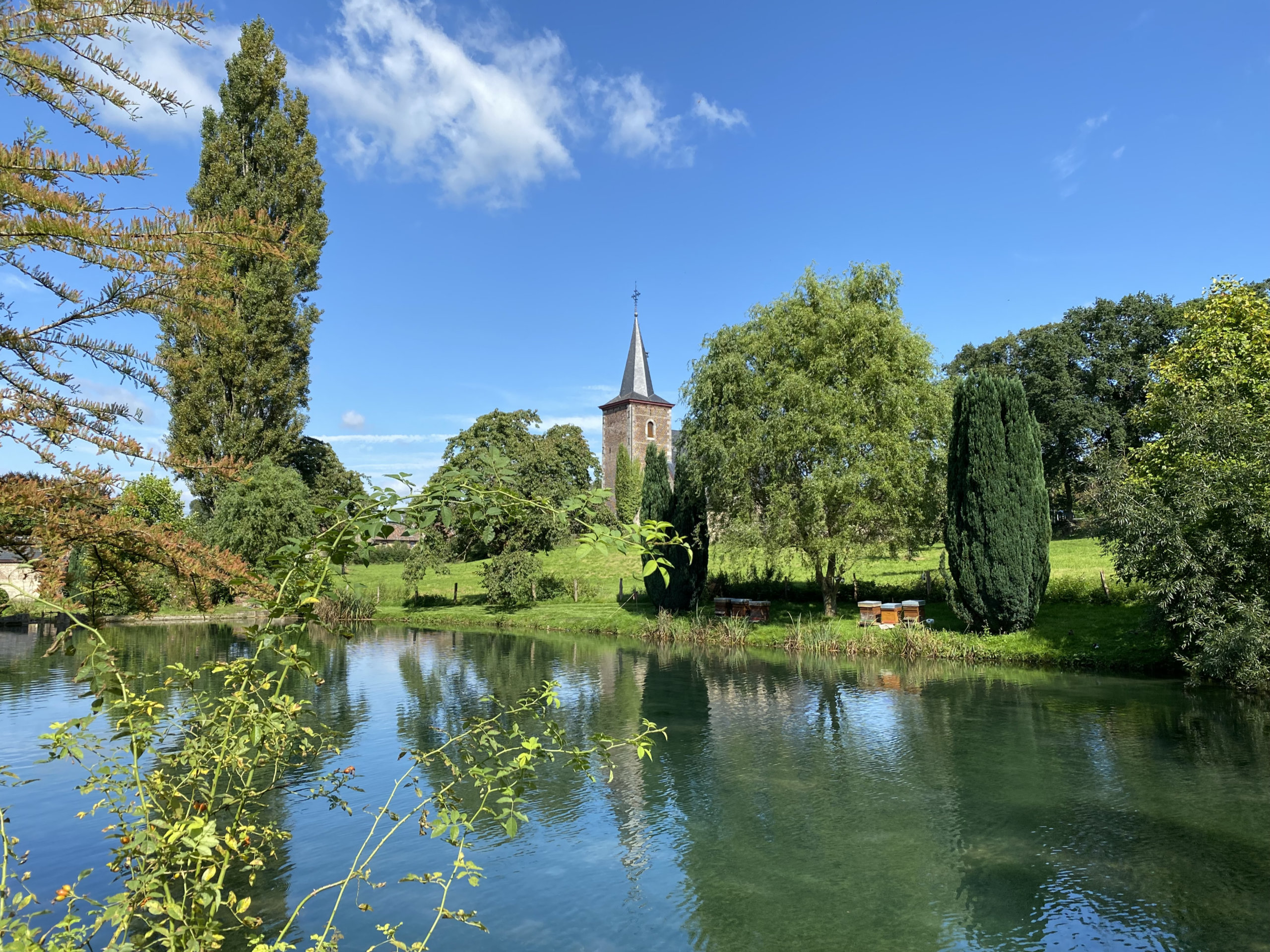
Voeren belongs to Flanders but is geographically separated from the rest of the Flemish Region. The municipality is part of the province of Limburg and borders the Dutch province of Limburg to the north, while the Walloon province of Liège surrounds it on the other sides. Voeren thus forms a Flemish, and more specifically Limburg, exclave along both a language border and an international border.
The landscape differs markedly from the image many travelers associate with Flanders. Voeren is hilly and characterized by stream valleys, meadows, hedgerows, sunken lanes, forests and traditional orchards with standard fruit trees. The municipality reaches elevations of up to 287 meters. In terms of landscape, it has much in common with the neighboring Walloon Pays de Herve.
With an area of 50 square kilometers and just over 4.400 inhabitants, Voeren is relatively small. Today’s municipality comprises six villages: Moelingen, ’s-Gravenvoeren, Sint-Martens-Voeren, Sint-Pieters-Voeren, Teuven and Remersdaal. Since the municipal merger of 1977, they have together formed the municipality of Voeren.
Sint-Pieters-Voeren: Spring, Commandery and Trout Ponds
Sint-Pieters-Voeren, known in French as Fouron-Saint-Pierre, is particularly distinctive. With around 300 inhabitants, it is the smallest of Voeren’s six villages. Here, nestled among hillsides, meadows and forests, the source of the Voer, a historic commandery and its associated ponds are all located close together.
The “Commanderij van de Duitse Orde” has its origins in the Teutonic Order. When Daniël van Voeren joined the order in 1242, he transferred his possessions in what was then the County of Dalhem to it, and the Flemish heritage inventory links this property to Sint-Pieters-Voeren. The first commander known by name is mentioned in 1320. The complex visible today, however, is the result of several phases of construction. Some of the oldest surviving sections date from the 17th century, while other parts were built in the 18th century. At the end of the 19th and beginning of the 20th century, the complex, which had by then fallen into serious disrepair, was restored.
The ensemble includes a park, moats and several ponds. One of the springs of the Voer rises on the grounds and feeds the ponds before the water continues through the municipality as the River Voer.
The ponds are more than just a picturesque backdrop. The Flemish heritage inventory documents fish farming on the site from around 1885. Trout are still bred and processed here today. The “Commanderie 7” includes a shop and a restaurant serving, among other things, trout dishes. In summer, visitors can sit outdoors in a picturesque setting around the ponds.
The fish farm grounds are not a freely accessible public park. According to the operator, access is intended for customers of the shop and restaurant, while guided tours are offered by reservation.
Just a few steps from the commandery stands the small Sint-Pieters-Stoelkerk. It was built in the mid-17th century: the choir dates from 1652, the nave from 1660 and the tower from 1661. The church stands within a walled cemetery and is protected as a historic monument.
Other Places worth seeing in Voeren
Those wishing to explore more of the municipality will find several other interesting places just a few kilometers from Sint-Pieters-Voeren.
In Sint-Martens-Voeren, a large railway viaduct spans the valley. The 250-meter-long concrete arch bridge is between 18 and 23 meters high, depending on the location, and was built during the First World War as part of a railway connection toward Aachen constructed by the German occupation authorities. Today, the viaduct is protected as a historic monument.
The submunicipality also includes small hamlets such as Veurs. Buildings made from flint found in the region can be seen there. Parts of the surrounding landscape, with its slopes, embankments and historic landscape features, are also protected.
In ’s-Gravenvoeren, the largest of the six villages, the Voer flows through the middle of the historic center. Numerous small bridges connect houses on the opposite side of the stream with the road. The historic village center around Pley and Kinkenberg is protected as a townscape and landscape.
Teuven lies farther east on the Gulp. A striking landmark is the elevated Neo-Gothic Sint-Pieterskerk. The surrounding area is also home to the De Hoof estate and Sinnich, a former Augustinian convent that later passed into private ownership.
Why does Voeren belong to Flanders?
Voeren’s present-day position is closely connected with Belgian language legislation introduced in the early 1960s. Until then, the six municipalities belonged to the province of Liège. When the language border was established by law, they were assigned to the Dutch-speaking area and transferred from the province of Liège to the province of Limburg. The new arrangement came into effect on September 1, 1963.
The frequently used shorthand that Voeren was “moved from Wallonia to Flanders” at that time is historically somewhat imprecise. What changed initially was its provincial affiliation and its assignment to a language area. Belgium’s present-day regional institutions were only established through later state reforms.
The planned transfer was controversial locally. On October 28, 1962, the Provincial Council of Liège organized a consultation. Sixty-seven percent of eligible voters took part, and 93 percent of those who voted supported remaining within Liège under a French-language administrative regime with facilities for Dutch speakers. The consultation, however, was not a binding national referendum, nor was it a survey of which language residents actually spoke. The provincially transfer approved by parliament was subsequently implemented as planned.
Dutch-speaking Area with Language Facilities
Today, Voeren belongs to the Dutch-speaking area. Dutch is the municipality’s administrative language. At the same time, Voeren is what is known as a municipality with language facilities. Special legal provisions apply to French-speaking residents, allowing them in certain circumstances to use French in their dealings with the municipal administration. Voeren is therefore not part of an officially bilingual language area such as the Brussels-Capital Region, but rather a municipality in the Dutch-speaking area with language facilities.
It is not possible to determine precisely from official statistics how large the Dutch-speaking and French-speaking population groups are today. Belgium’s last census containing questions about language was held in 1947. Current percentages concerning the language residents use in everyday life should therefore not be treated as official population statistics.
When Voeren became a national political Issue
The conflict over language and administration became particularly prominent in the 1980s. Following the 1982 municipal elections, the French-speaking politician José Happart played a central role. One of the main issues in the years-long legal dispute was the level of Dutch-language proficiency that the mayor of a municipality in the Dutch-speaking area was required to demonstrate or possess.
Belgium’s Council of State ruled on the Happart case in 1986. Further disputes then followed concerning his role as first alderman and acting mayor. As a result, the Voeren issue developed far beyond the municipal level into a conflict within the Belgian federal government.
In October 1987, the unresolved conflict over Voeren and José Happart ultimately led to a government crisis. On October 15, Prime Minister Wilfried Martens offered the resignation of his Martens VI government, four days later, King Baudouin accepted it. Martens then led a caretaker government, largely with the same team, until the early parliamentary elections.
The dispute over the administration of a municipality with only a few thousand inhabitants had thus become an issue that directly affected the stability of Belgium’s federal government.
A Landscape at several Borders
Visitors arriving in Sint-Pieters-Voeren today are confronted first not with Belgian constitutional history, but with a small village set among meadows and wooded hillsides: the church, the source of the Voer, the historic buildings of the commandery and the trout ponds.
Nevertheless, the area’s unusual location is difficult to separate from the place itself. Politically and administratively, Voeren is unequivocally part of Flanders, while in landscape terms it lies directly alongside the Walloon Pays de Herve and also borders the Netherlands. The language border, which is hardly noticeable during a walk, has played a decisive role in shaping the municipality’s history.
For this reason, Sint-Pieters-Voeren is a particularly suitable starting point for discovering Voeren: not because it can objectively be called the “most beautiful” of the six villages, but because landscape, water, historic heritage and a trout farm that is still in operation today all come together within a very small area.

 © VisitBelgium.net
 © VisitBelgium.net
 © VisitBelgium.net
 © VisitBelgium.net
 © VisitBelgium.net
 © VisitBelgium.net